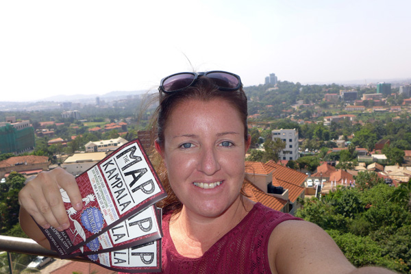
Hi! I’m Kirsty and I’m the one-person ‘team’ here at Africa Guide Maps.
The Idea
I sort of started this whole map thing by accident. I found my way to Kigali as a traveller back in 2010 and sort of just stayed. I started a website (aptly named, Living in Kigali) shortly after I arrived because I knew how to make websites and Kigali was sorely in need of one. In the process of building up the website and writing content, I spent my days visiting loads of places around town, researching, and eating at as many cafes and restaurants as humanly possible.
Somewhere along the way I came across a really, really terrible city map of Kigali. Sure, it was free… but it was really awful and about five years out of date. Then I had a bit of an ‘ah ha!’ moment – I’ve always liked maps, I like design and drawing, and I was gaining lots of great information about Kigali as I researched for my website. ‘Why not make a decent map of the city?’, I asked myself. ‘Because I have no idea how to make a map’, I answered myself. ‘How hard could it be!?’ I asked myself again. At this point I became worried for my mental well being, stopped talking to myself, and just got on with learning how to make a map.
As it turns out, learning how to make a map from scratch with no prior experience whatsoever is quite difficult. The whole process, start to finish, took me three years. Three! True, a lot of that time was spent in frustration ignoring the map because I didn’t know how to proceed, but I got there eventually.
Having learned the awesome new skills for making my first map and getting the thing printed and through customs (a whole story in itself), I felt like I wanted to make more. And so I did. And I seem to keep going.
The Process
The most common question I get asked, by far, is ‘how do you make the maps?’ So here’s a bit of a glimpse into the incredibly time-consuming and rather insane process. Each map takes around 1.5 years to complete and I work on them pretty non-stop.
Before Arrival
There’s so much I need to get done before I even set foot into the city I’m working on. My aim is always to have the graphic design work as completed as possible before I even set foot into the city. This never happens, but it’s the goal!
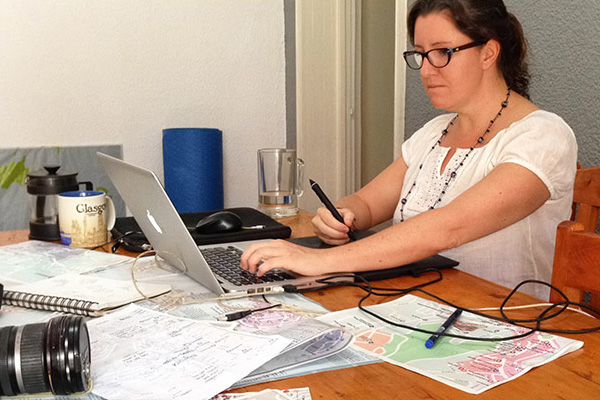
- Make the Base Layer – Using a variety of sources, I piece together a ridiculously gigantic base layer map of the city using Photoshop. It’s like assembling a giant puzzle in my computer. Then I take that file over to Illustrator where I laboriously and ridiculously trace the entire thing, street by street, park by park, river by river. I do this using my mouse and end up with a sort of claw hand at the end. Nairobi took me two months, just to give you an idea of how dumb this whole process is, especially since I know there are other ways to get a base map. I do it this way to familiarize myself with the city and to have full control over the final product. Plus it’s sort of like a weird meditative process for me and, besides the painful hand, it’s weirdly fun. The base layer is still fluid at this point because I won’t know what map borders I want to use until I actually go to the city, but it gives me a great starting point to work from.
- Plotting Points of Interest – When I have a base layer with streets, highways, parks, rivers, lakes, and all of that fun stuff, I then start to plot actual points of interest. This means I take every map I can find online (Google, Open Street Maps, Trip Advisor, etc.) and look for restaurants, cafes, hotels, bars, gyms, stadiums, churches, mosques, shops, NGOs, government offices, museums, and whack everything I can find onto my own map. Much of what I find online is out of date and incorrect, but I plot it anyway and it gives me something to work from.
- Internet Research – One a picture of the city starts to form for me, I start to dive into research in a big way. I read everything I can about the city both online and offline. I devour blogs, I read restaurant and hotel reviews, I read neighbourhood guides, I find statistics… really anything and everything I can get my hands on. Some of it just gives me a more well-rounded idea of the city, and most of it gives me a starting point for my own research once I actually get to the city. I also research things like taxes, customs, the process of setting up a business, how to open a bank account, visas, and all of that boring but essential stuff.
- Crowd Sourcing Information – Before I arrive I also try to make as many contacts as possible and to gain as much local advice, tips, and information as I possibly can. I do this by reaching out to friends, friends of friends, friends of friends of friends, enemies of friends, enemies of enemies, and anyone I can think of who lives or has ever lived in the city. I have a little survey I send out to people that gives me a great starting point for what places are popular.
- Drawing and Design – I try to make sexy maps and improve the design with each new map I make. I’m always tinkering around with fonts and colour scheme and I’m constantly adding new drawings to the maps. When I’m drawing buildings I usually wait until I’m in the city so I can snap a photo in person to work from. But often I’m adding cartoons of animals or people and I try to get as much of that done as possible before I arrive as it’s very time consuming.
- Making Contacts and Creating a Buzz – People seem to love maps and many folks get a bit excited when they hear about my project coming to their home city. Finding these people is key because they act as champions for the idea and often connect me to future advertising and distribution partners. Finding one or two excited people usually leads to a whole slew of contacts and I try to reach out to as many of them as I can. Making the map is the easy part – it’s the sales part that I’m not so crazy about and the more contacts I have, the easier this part will be.
Research Trips
Once I’ve got a decent base map and a good number of points to work from, I’ll start with my research trips to whichever place I’m working on. How long I spend in each place depends on how big the city is. For Addis Ababa, I took five trips totaling around five months, Kampala was a bit less, and Nairobi has been three trips of five months so far. I’ll usually go for about a month to six weeks on each trip, work non-stop every day with clear plan, and then leave with loads of information to work with while I’m away. Then repeat.
- Researching Points of Interest – With my base map in hand, I print out the entire thing on A4 sheets, attach it to my trusty clip board and then hit the streets. With each map I probably walk down around 80% of the streets to see what there is to see and to make sure what I have plotted is accurate. What I see in person is always vastly different to what I’ve plotted on my base map so the pages on my clip board end up with scribbles and writing all over the place. It would probably unreadable to anyone else but somehow it works for me. I take the crazy sheet of notes and then plot it all onto the file on my computer and repeat until I’ve covered the entire city. It takes forever but exploring each place on foot is one of my favourite parts of this whole process.
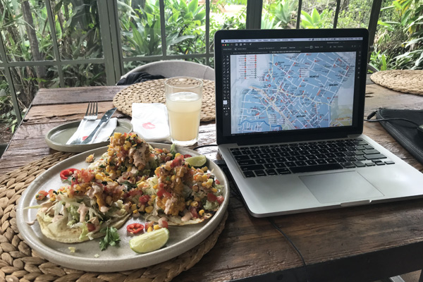
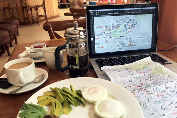
- Researching Restaurants and Cafes – These maps are more like a guide than just a basic map and that means they’re packed with recommendations for places to visit. Many of these suggestions are restaurants and cafes and that means that I have to visit each one so I can write a short two-line review. My research trips always involve a crazy amount of eating out… almost more than the average person can handle. I’m certainly not going to complain about it because it’s an awesome way to be able to try loads of restaurants, but eating out at least twice a day does kind of make me crave a plate of steamed broccoli by the end.
- Researching Everything Else – When I’m not eating all of the things, I’m usually stopping by gyms, pools, gift shops, and other places like that to check them out and see whether I should include a blurb about them on the map. I usually do this at the end, hopping around from place to place in taxis.
- Meetings – Once I’m in town I have a lot of people I need to meet with. This could mean bribing clued-in residents with lunch so I can pick their brains, visiting various print shops to see who can print and fold the maps to a high standard (this is new for Nairobi, previously they were printed in the UK), meeting with lawyers, accountants, and bank managers about the bureaucratic side of running a business, or having countless sales meetings to try to sell ad spaces on the maps or to set up distribution.
Selling the Maps
This is the part I like the least as I’m not a massively huge fan of selling. I could make maps forever… but I also have to make money, I suppose. The more eyeballs my maps appear in front of the better so I have to hit the streets, maps in hand, and go in search of potential distributors to sell to. It can be soul destroying or very uplifting, depending on how things go.
- Marketing and Point of Sale Materials – I’m usually super burnt out at this stage and don’t want to look at my maps until it’s time to reprint them but, alas, I still need to make some materials to make them easier to sell. I usually just print up bright A3 or A4 posters that say ‘On Sale Here!’ or something along those lines. In the past I’ve had some crappy plastic display boxes but I’d really like to up my game with point of sale materials going forward, so I’ll need to also figure that out.
- Sell, Sell, Sell – In the past I’ve sort of just walked around, popping into hotels with my maps to show people and try to make a sale. This time I think I’ll be smarter and call as many places as possible and try to set up meetings with the correct person. Embassies and NGOs that bring in a lot of new staff or guests are good markets for me so working at getting those contacts is key.
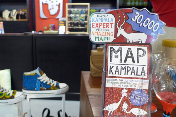
- Distribution and Payment Collection – Since I don’t live in any of the places where I sell my maps, I need to either collect all of the payments up front which works for the ad spaces but doesn’t work so well for the map sales. It’s more realistic that I’ll be distributing maps and collecting payment throughout the year. This means I have to come up with a person and system to do this. In Kigali my accountant does this part, in Kampala my maps are currently with a friend, and in Nairobi… who knows! I’ll figure that out later. I hope.
Reprinting the Maps
The process of making these maps is fun but super labour intensive. I don’t even want to think about how many hours I spend working on these things. When I’m in town on research trips, I’m working from when I wake up to when I go to sleep each day – and when I’m falling asleep I’m usually thinking about the maps and my plan for the following day. It’s actually sort of insane.
The only thing that makes these maps even remotely viable when you consider the time they take to make is the idea of a reprint. Reprints won’t take nearly as long to make, I’ll have already set up the business, bank account, and all of that stuff, in theory most of the advertisers will renew, and the distribution network will already be set up. I’d love to get all of my maps in sync to that I can work on reprints over the winter months, printing just enough maps so that I can do a new one annually so they’re never too far out of date. That’s my master plan… we’ll see how things turn out!
Get in Touch
If any of this sounds at all interesting and you want to know more, please get in touch at info@africaguidemaps.com or you can follow along on my Instagram account as I finish up my Nairobi map. I love to talk maps so don’t be shy!